
Thou shalt not remove thy neighbor’s landmark… Deuteronomy 19:14
Why do you suppose the supreme law giver, God, addressed and instructed through Moses in early biblical times that the people not remove their neighbor’s landmark? For the very same reason that the laws of our land today instruct us not to do so.
Disputes, confrontations, arguments, and even physical violence could, and oftentimes would, ensue. Over the course of history, what have countries warred over more than any other? Land and its boundaries…
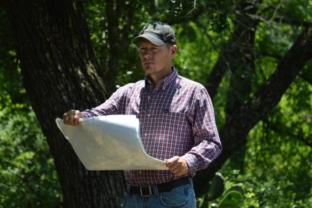
So, professional surveying (defined below) is an extremely important practice.
Professional Land Survey Defined
Texas Occupations Code, Sec. 1071.002., Subtitle C, Title 6:
6.) “Professional surveying” means the practice of land, boundary, or property surveying or other similar professional practices. The term includes:
(A) performing any service or work the adequate performance of which involves applying special knowledge of the principles of geodesy, mathematics, related applied and physical sciences, and relevant laws to the measurement or location of sites, points, lines, angles, elevations, natural features, and existing man-made works in the air, on the earth’s surface, within underground workings, and on the beds of bodies of water to determine areas and volumes for:
(i) locating real property boundaries;
(ii) platting and laying out land and subdivisions of land; or
(iii) preparing and perpetuating maps, record plats, field note records, easements, and real property descriptions that represent those surveys; and
(B) consulting, investigating, evaluating, analyzing, planning, providing an expert surveying opinion or testimony, acquiring survey data, preparing technical reports, and mapping to the extent those acts are performed in connection with acts described by this subdivision.
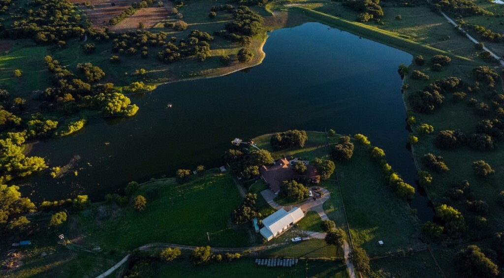
In a land transaction, some parties often view the survey as just an additional expense, a hindrance or nuisance, something that could potentially uncover issue(s) that need to be addressed and/or remedied as it relates to the Seller’s ability to sell and Buyer’s ability to purchase a property, ultimately delaying, or even preventing a closing to occur. As a land Buyer or Seller, you want to ensure that the location of the boundaries and the amount of land that you are purchasing or conveying is correct. So, it would stand to reason that you would want to protect your “landmark,” i.e. those features that identify the boundaries and location of your property.
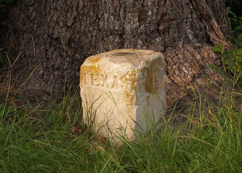
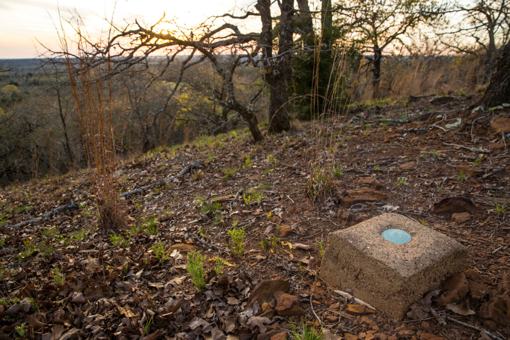
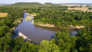
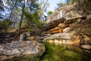
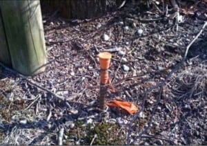
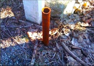
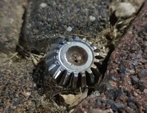
Today, we refer to these “landmarks” more often as “monuments,” and in the surveying world, there are two kinds of monuments: natural and artificial. “Natural” monuments being those that have occurred naturally, such as rivers, creeks, streams, trees, rock outcroppings, etc. And of course, “Artificial” monuments being those made and/or placed there by man, including stone mounds, rock piles, wooden stakes, axles, railroad spikes, small and large nails, concrete pillars or blocks, cotton spindles, metal pipes or rebar of varying lengths and diameters, aluminum or brass capped discs set in concrete, etc. My all-time favorite example of an artificial monument is a gun barrel that was said to have been driven at the southwest (SW) corner of a ranch in Bosque County, near Iredell, Texas. (Unfortunately, as we were surveying that property, we discovered that the gun barrel was no longer there and had been replaced by a fence corner.)
In land surveying today, we are simply attempting to follow in the footsteps of the original surveyor, but there is much that this entails. Rather than go into a full-on surveying lesson, we will briefly discuss a few aspects of how a survey is carried out, beginning with what is referred to as the “dignity of calls.” The “dignity of calls” provides the surveyor with items that control (by order of significance) or carry more weight than others as they follow in the steps of the previous surveyor in an effort to verify, reconcile, and/or reconstruct, if necessary, the boundaries of a property according to record evidence.
Dignity of Calls in Order of Importance
1. Natural Monuments
Natural monuments are the first order of importance or significance. These monuments are held above all others unless there is some other evidence of record that clearly shows this is not the case.

2. Artificial Monuments
Next, we would rely on recovery of artificial monuments. These would be held as controlling property corners/boundaries if reconciled and proven to be in the correct location according to record evidence.
3. Courses (Bearings)
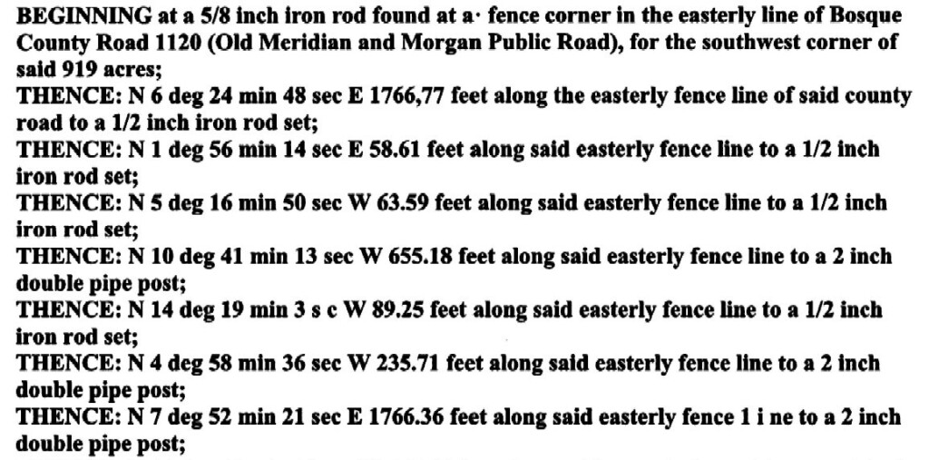
Following monuments, our next controlling item would be “course,” or what you may often hear referred to as the bearing(s). For example: Thence N 30° 27’ 37” E and Thence S 59° 32’ 23” E, which by the way these two courses or bearings shown, make a 90° angle/corner. The metes & bounds description shown below contains seven (7) different courses.
4. Distance
Today, measurements are most commonly recorded in feet; for example: 5,280.00’. With continued advances in technology, surveyors are able to measure very accurately, over great distances, and with relative ease using RTK (Real Time Kinetic) GPS surveying equipment. However, still common in some earlier descriptions, especially in Texas, you might find measurements in rods (16.5’ per rod), chains (most commonly a Gunter’s chain which consisted of 100 links each 0.66’ in length and totaling 66.0’ per chain), or varas (often referred to as the “Spanish yard”). The vara was commonly used as a means of recording distance in early Spanish and Texas land grants and even early re-surveys and/or subdivision of lands. In Texas, one vara is commonly considered to be 33-1/3”. To convert varas to feet, you simply divide the distance in varas by 0.36. For example: 1,900 varas divided by 0.36 = 5,277.78’ or ~ one mile.

5. Acreage (Area)
Lastly, we have area or acreage. Often in early Texas, especially west/northwest, the original land grants were measured in Sections consisting of 640 acres (also known as a square mile or tract of land measuring 5,280’ by 5,280’), half sections of 320 acres, or quarter sections of 160 acres. As settlers continued to move west, the railroads soon followed. As an incentive for these rail lines to be laid, the state granted 16 sections of land to the railroad for every mile of track laid. In part, the railroad would also have to survey out an additional section of land for each of its sections that the state would retain. There were often great discrepancies and large amounts of excess acreage found in many of these early railroad surveys. Today, area fluctuations tend to be much less prevalent and may only differ from previous surveys by a few hundredths or thousandths of an acre.
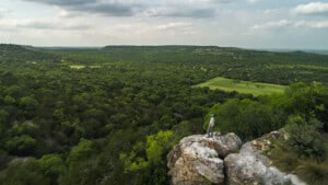
Why is a Land Survey Important Today?
 As land has historically proven to be a very safe and solid investment – one that you can actually put your feet on and dig your hands into, there is great satisfaction in owning land. As prices have recently soared and properties have sold at a pace never before seen, don’t you want to protect that investment? Of course! So, protect your landmarks. Don’t let the fence builder go out and use the survey monuments that mark your property corners as targets for the center of their post holes. Maintaining and protecting the monuments that identify your property corners and boundaries will leave very little room for confusion, error, and potential for improper reconstruction of a missing corner. Can the corner be relocated? Sure. Any competent land surveyor can reconstruct and relocate boundaries and corners that may appear to be in question. But errors do occur, and with the prices of land at all-time highs, there is an increased liability on the surveyor. For many, a land purchase will be the single greatest monetary investment they make in their lives, and ensuring that the boundaries of that asset are correctly located and marked should be of utmost importance. To most surveyors it is, and they take great pride in practicing their craft with the highest diligence and effort to ensure the survey is done correctly to protect the interest and welfare of the public.
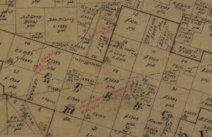
The History of Texas Land Surveys
 If you like history, especially Texas history, it might interest you to know that, in the early days, as Texas was being colonized and surveyed under the authority of the State of Texas, much of what was surveyed early on, as this wild land was being scouted, was being done so by men who had military experience and who served as both land surveyors and Texas Rangers. Just to name a few of these Texas Rangers/Surveyors:
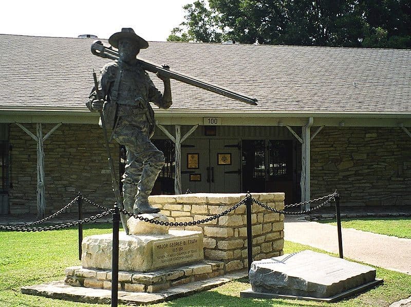
Major George B. Erath (for whom Erath County is named and where Stephenville, Texas is the county seat) and the legendary Texas Ranger Captain John “Jack” Coffee Hays (for whom Hays County is named and where San Marcus, Texas is the county seat).
The Texas Ranger Hall of Fame Museum, located in Waco, Texas, is a great place to visit for those interested in these brave men and women who served, and continue to serve, our great state in the time honored and prestigious branch of law enforcement. The museum also has a great exhibit that shows the early ties between surveying and Texas Rangers, including early surveying instruments used and many stories that were recorded as they surveyed these wild new lands.
Written by Bret Polk, Registered Professional Land Surveyor since 2008 and Licensed Texas Real Estate Salesman since 2012 including Top Producer of the Year- 2016, 2017, 2019, 2021.